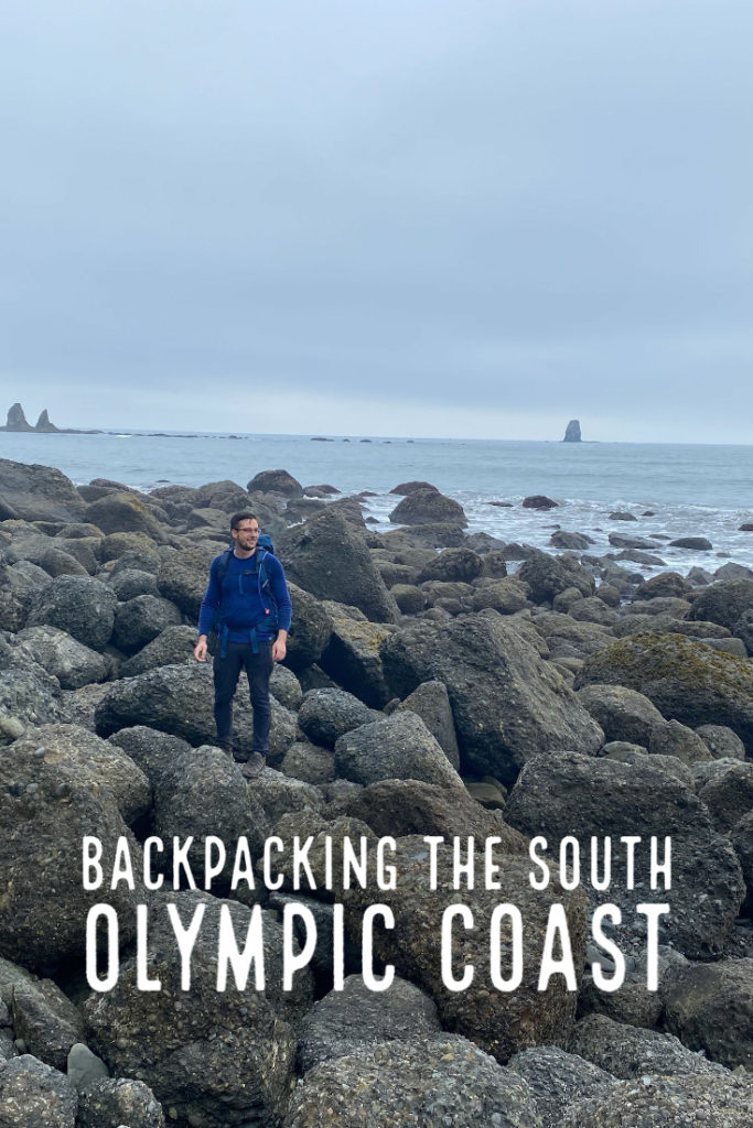
The Olympic National Park is known for its wilderness and staggering beauty. The park is huge, encompassing much of the Olympic Peninsula in Washington. The South Olympic Coast is just a small portion of the Park.
Not many realize, though, that the park is not continuous. One portion of the park contains the Hoh Rainforest, Mount Olympus, and the wild, unreachable interior. The other portion lines the coast, with views of sea stacks and perpetual mist.
During a smokey, hot weekend, we escaped the unusual heatwave for a backpacking trip on the South Olympic Coast. In this post, I’ll describe our experience backpacking the trail. I hope our experience encourages you to try this trail or helps you for a trip you have already planned.
Getting to the South Olympic Coast Trail
Part of the attraction of the Olympic National Park is how untamed it is. Most of the park is free from the blights of tourism, but that also means that amenities are few and far between. For those coming from Seattle or the Puget Sound area, you may find yourself driving around the north side of the Peninsula.
Along the way, you have chances to stop for meals or pick up any last-minute supplies in Sequim (pronounced Squim!), Port Townsend, or even Forks. Lake Crescent offers a great opportunity for pictures of the gorgeous blue water or a bathroom break.
Forks is definitely the last stop for gas, food supplies, or plumbed restrooms. We forgot to pack our coffee for this trip, so coming back through Forks on the way back, we stopped at one of the several coffee shacks.
If you come from Olympia or further south, such as Portland, you may drive around the south side of the Peninsula.
The night before, we camped in one of the many DNR (Department of Natural Resources) campgrounds in the area. The Cottonwood Campground is the closest campground to the Oil City Trailhead. While the reviews say the campground only has eight official sites, you can disperse camp anywhere you can find a spot. Make sure you follow all rules for leave no trace and bear safety. As the campground is close to the Hoh River, you can also stock up on filtered water.
Tidal Restrictions Along the South Olympic Coast
When planning your hike, the trail guides and maps will mention the tidal restrictions along the route. When the ranger sent our permit, they also included a tide chart for our dates. They also recommended obtaining a custom correct map for the South Olympic Coast trail.
I got this map, which proved to be worth the cost, as it shows the tide restrictions with the tide elevation required for crossing. It was a paper map, so I laminated it at home.
The tide map showed that the low tide would be 2.1′ at 11:55 on Sunday, the second day of our trip. The custom map indicated that there was a 2′ tidal restriction, so I was concerned that we may not be able to cross the restriction.
Reading through other blogs, I could not really find a clear answer about how high the tides were when they crossed. In this post, I’ll provide pictures with the exact location and approximate tide height at that time. With a 2.1′ tide, we were easily able to cross the “dangerous areas” but I do not think we’d risk it any higher than a 3′ tide.
Oil City Trailhead
The Oil City Trailhead was only about 20 minutes from the Cottonwood Campground. We had a low tide of 1′ around 11:00 am on the Saturday morning that we started. We scheduled our morning backwards from that, aiming to start our crossing at the tidal about an hour before low tide. Therefore, we made sure we left the campground no later than 9:00 am.
Oil City Road dead ends right at the trailhead, with a small roundabout at the trailhead sign. There were quite a few cars at the trailhead, but we were reassured by running into so many backpackers starting the trail at the same time.
There is a pit toilet at the trailhead, so definitely make a stop before setting out.
The trail starts through some dense forest and a couple small stream crossings before meeting the Hoh River. When the view opens up, we gasped at the beauty, as did the backpackers right behind us. (If you watch our Youtube Video, you will definitely hear this audible gasp).
Hoh River to Jefferson Cove
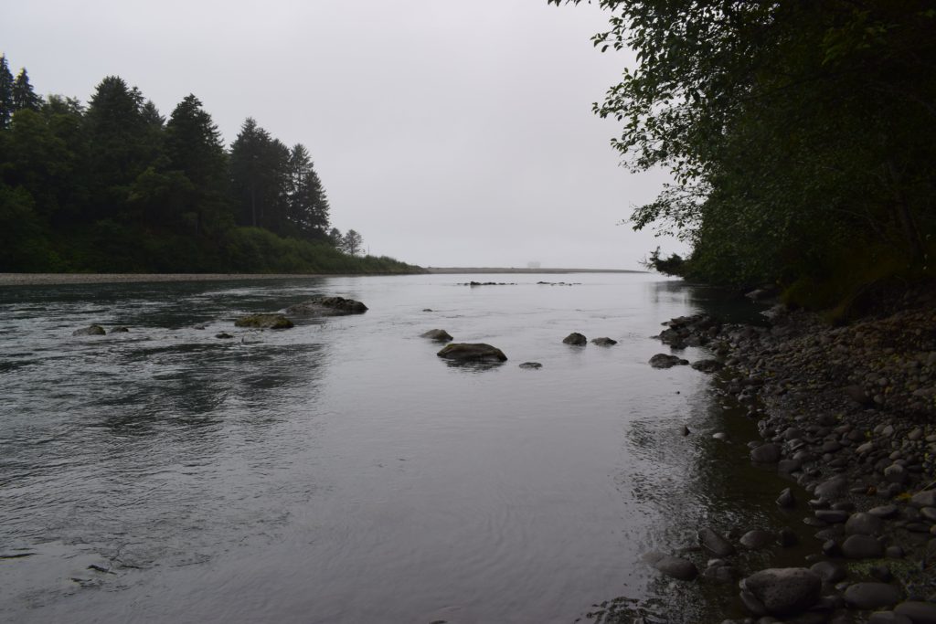
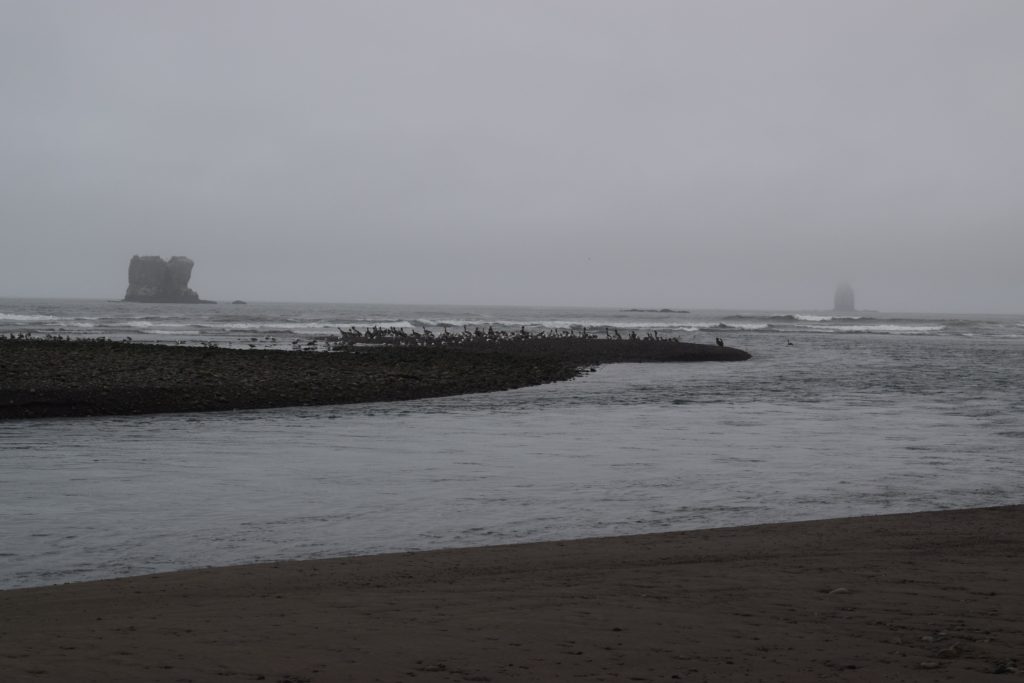
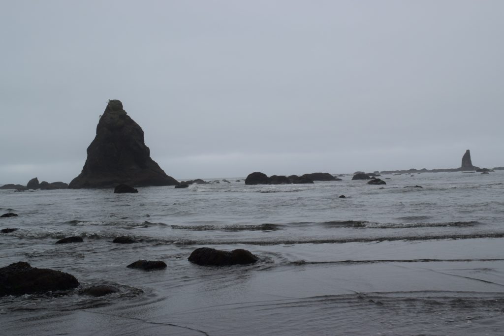
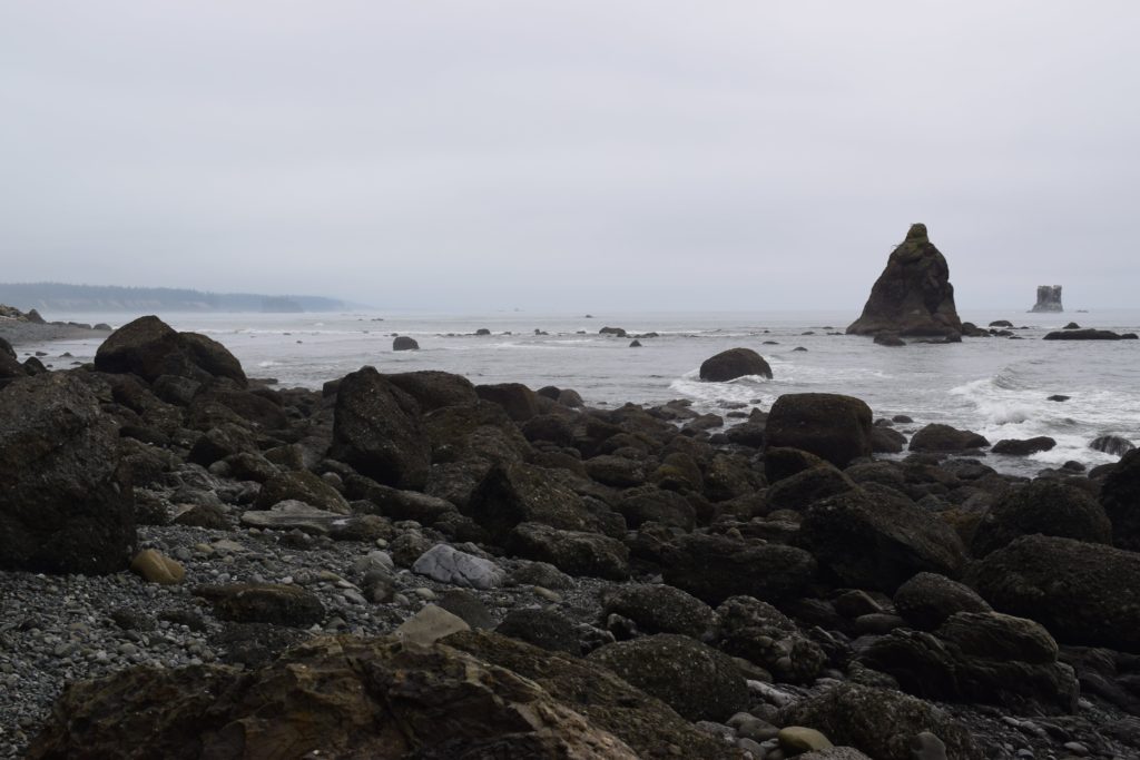
The Hoh River will steal your breath. Where the river meets the ocean, the shore is lined with smooth, weathered rocks, flat expanses of sand, and perhaps some pelican nests. Through the mist and fog, you may see several sea stacks, looming like anciet giants in the waves.
We thought that most of the trail would be like this, hiking in sand and rocks. However, we were wrong.
The tidal restrictions labeled on the map started just south of Diamond Rock, a large sea stack right off the shore in the waves. In this section of the coast, you must scramble over large boulders. The restriction is caused by a large boulder that cannot be scaled without rock climbing gear (or perhaps a lot of pluck). The rocks were very slick with seaweed. If you slip, you may brace yourself only to find your hands sliced up with barnacles hidden beneath.
We thought we were through with the restriction when we hit flat beach again, but soon after, we came upon another section of large boulders. Checking the map again confirmed that we were in the 1′ tide restriction area. Again, we met a point where a large boulder narrowed the hikable area to just a couple feet, between the rock and the waves.
After scrambling over rocks with our heavy packs, we sat in Jefferson Cove to enjoy a snack and the view while we caught our breath. Many other hikers did the same. Some even sat up camp. At the end of the cove, Hoh Head loomed above us.
Crossing Hoh Head
To leave Jefferson Cove, we had to climb up a rickety ladder. Several of the wooden rungs were missing. With this our only option, we shook our heads and went for it. Where rungs were missing, I had difficulty pulling myself up the four foot gaps, but relied on some rock climbing experience to find good footing in the slick mud behind.
Again, we thought the worst was behind us. However, after the first ladder, we had to scramble up a less steep but still difficult section. The second was made more difficult by the first two or three rungs being missing.
The rest of the trail was almost never flat. We were always either ascending or descending the same 40′, over and over again. Worse, our GPS/fitness trackers estimated a much further distance than what the map showed. We thought we were almost to camp at by no more than the halfway point between Jefferson Cove to Mosquito Creek.
Camping at Mosquito Creek
We finally came into the camp site at Mosquito Creek early in the afternoon. At that time, there was only one other backpacker who had sat up camp. From the humid day, sweating, and a lack of coffee, we had raging headaches.
After we dropped our packs and pitched our tent, we set out to explore the campground and surrounding area. We were too exhausted to do much more than walk the beach and filter water for dinner.
fFYI, the toilet at the camp is a very modest installation, with just two wooden fences for privacy. The toilet fixture is affixed to plywood that covers the pit. According to park rules, if a restroom is available within 1/4 mile, you are obligated to use it.
Our site had some benches which made making dinner easy. After eating, we hit the sacks by 7:00 pm.
The next morning, we made breakfast and broke down camp.
Return to Hoh Head
The previous day, we hiked the 6.5 miles from the trailhead to Mosquito Creek, though we had gotten a bit off the trail through one section which delayed us briefly. By that estimate, we needed to leave Mosquito Creek with at least three hours of buffer between ourselves and 11:55 am, which was the low tide mark of 2′ for that day.
We made it back down to Jefferson Cove by 11 am, which didn’t give us time to take a break before crossing the tide restrictions.
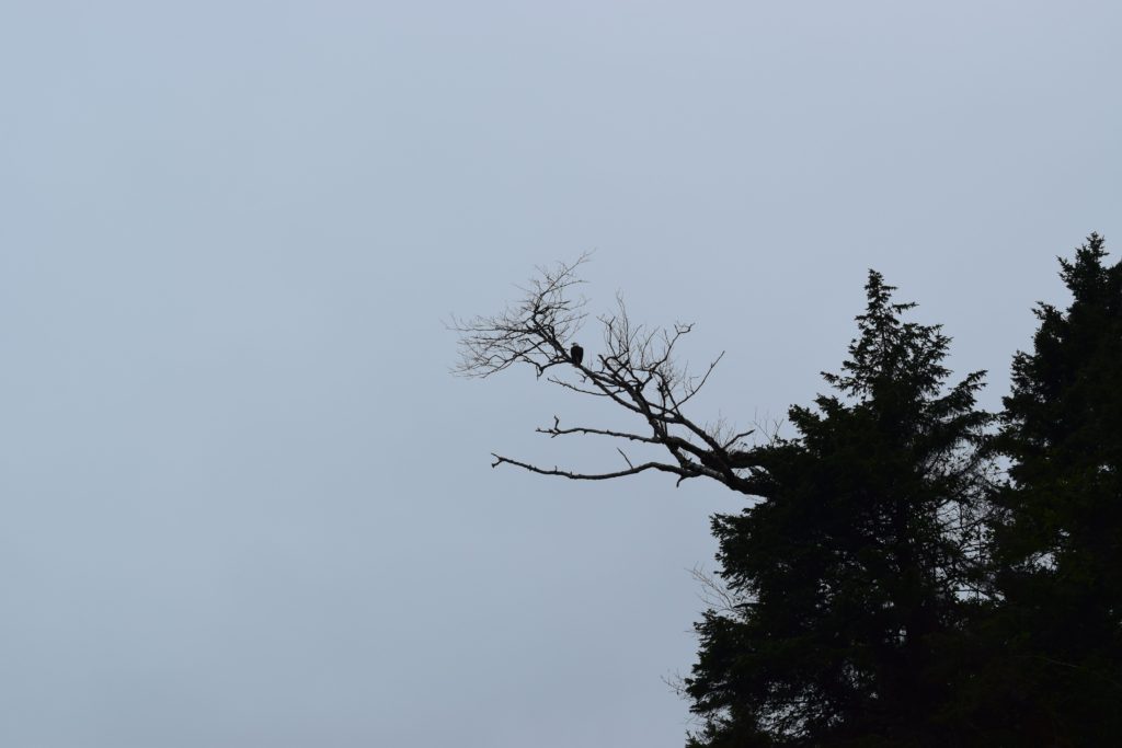
I was extremely tired by that point, which caused me to slip or misstep several times in the slippery rocks. After the tide restriction zones, we rested several times and enjoyed the views, even seeing a bald eagle. We made it back to the trailhead by about noon.
Tips for Backpacking the South Olympic Coast
Although we thoroughly enjoyed our trip backpacking the South Olympic Coast, there are a few things we would have done differently:
- Pack Coffee: This can go for any normal habit you might enjoy, medications you take, or other rituals. Backpacking is not a good time to try a new routine.
- Don’t Underestimate the Effort: Despite this trail not having a large ascent, the trail is difficult and not well maintained. We used a lot of our energy crossing logs or climbing steep portions of the trail.
- Prepare for Humidity: Even though the weather was cool, the humidity can cause you to feel warmer, as sweat does not evaporate as well in high humidity situations. In much colder weather, the dampness can make you feel more cold.